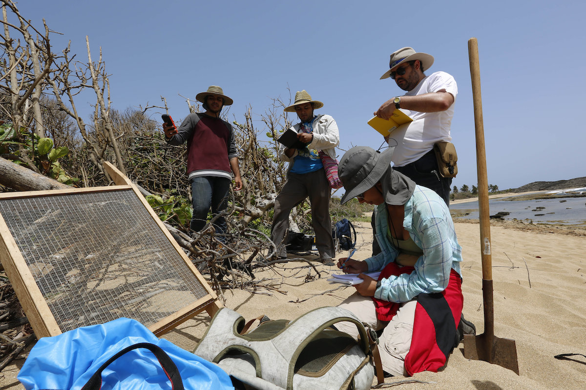

In this June 14, 2019 photo provided by Fabio Esteban Amador, Puerto Rican students of the Center for Advanced Studies for Puerto Rico and the Caribbean, and their professor Isabel Rivera-Collazo, kneeling, study the impact that Hurricane María had on coastal archaeological resources and ecology in Manatí, Puerto Rico. (Fabio Esteban Amador via AP)
By DÁNICA COTO, Associated Press
SAN JUAN, Puerto Rico (AP) — A group of U.S.-based scientists is rushing to document indigenous sites along Puerto Rico’s coast dating back a couple of thousand years before rising sea levels linked to climate change destroy a large chunk of the island’s heritage that is still being discovered.
Scientists hope to use the 3D images they’ve taken so far to also help identify which historic sites are most vulnerable to hurricanes, erosion and other dangers before it’s too late to save the island’s patrimony.
“It’s literally being washed away,” said Falko Kuester, director of the Cultural Heritage Engineering Initiative at the University of California, San Diego, which is involved in the project. “A big part of what we’re working on is to make the invisible visible and make sure it stays in our memory.”
Also involved in the project are UCSD’s Scripps Institution of Oceanography and Para la Naturaleza, a nonprofit environmental group based in Puerto Rico.
The first site scientists targeted was a large swath along the U.S. territory’s north coast that includes a ceremonial center used by the Taino Indians roughly 2,000 years ago, said Isabel Rivera Collazo, an environmental archaeologist at UCSD who is overseeing the project that began in August 2017.
Scientists discovered what appears to be a large settlement just east of the ceremonial site thanks to drones and technology including 3D images, she said. They were also able to determine the shape of the ceremonial site, she added.
Armed with that information, scientists used excavations to determine that one of six plazas previously discovered appears to have been used for ceremonial dances and the veneration of ancestors.
“The inside of the plaza was intensively trampled,” Rivera said.
The Taínos populated various Caribbean islands but were eventually wiped out after the arrival of Christopher Columbus and European settlers.
“Up to today, there is still a lot we don’t know about indigenous culture along our coasts,” Rivera said. “It’s not in our history books.”
“The entire coast is blanketed with archaeological sites,” she said. “We want to recover that information before it disappears.”
Puerto Rico’s Department of Natural Resources has said the sea level around the island is rising by more than 3 millimeters —a little over a tenth of an inch— per year. But climate change has more immediately dramatic effects as well, destroying habitats, eroding coastlines and causing more powerful storm surges when hurricanes hit.
Some scientists say that warmer temperatures increase the frequency and intensity of storms. Puerto Rico is exposed to storms every year for six months during the Atlantic hurricane season, and the scientists noted that the storm surge from Hurricane Maria washed away part of the region they’re studying.
“It’s literally in the eye of the storm quite regularly,” Kuester said of the island.
Eric Lo, an engineer with the UCSD’s cultural heritage initiative, flew to Puerto Rico in August 2017 to launch the project a month before Maria hit the island as a Category 4 hurricane. Lo was surprised at what he saw upon his return to the U.S. territory months later.


This photo combo provided by Eric Lo shows the shoreline in Manatí, in August 2017, left, before Hurricane María and in November 2017, after María. (Eric Lo via AP)
“Pieces of land where I had stood and flown the drone didn’t exist anymore,” he said. “They were underwater.”
Scientists are now trying to determine the extent of coastal erosion in that region and the hurricane’s impact on the archaeological site they are studying.
Three-dimensional models based on drone images are being used to measure distances, areas, volumes and explore fine details: “You start asking these details that historically you couldn’t,” Kuester said.
The engineering initiative that he oversees has helped explore other historic sites elsewhere, including an underwater cave with prehistoric fossils and a baptistery in Florence, Italy.


